

 Bradner Preserve
Richmond, Richmond Rural Preservation Land Trust

![]() 1.3 miles of trail
1.3 miles of trail
Moderate
Hunting is not allowed here but it is permitted on nearby land. Wear blaze orange during hunting season. More information
Click on the "Trail Map (PDF)" button to download a PDF of the trail map that you can print and take with you on the trail.
Avenza maps are special, free maps that you can use in the Avenza app on your smart phone. These maps let you see your location on the map as you walk. Download the Avenza App for free in the Apple App Store or on Google Play
Click on the Avenza Trail Map button to "purchase" the free map for this trail from the Avenza map store. If this is your first time, Avenza will ask you to set up an account to check out. However, all Avenza trail maps listed on ExploreRI are free.
In Rhode Island the primary hunting seasons typically run from the second Saturday in September to the last day of February and from the third Saturday in April to the last day in May, however this can vary from year to year and depends on what game is being hunted. During hunting season you should wear at least 200 square inches (a hat OR a vest) of blaze orange. During shotgun deer season, which is typically in December, you should wear at least 500 square inches of blaze orange (a hat AND a vest). For more information see the RI DEM website.


This is a pleasant, 64 acre property in Richmond. The trails are great for family hikes or walking your dog. The Hanging Rock Trail (the main trail) is 4 feet or wider and good for equestrian use; Wolf Tree Trail is a 1 person foot path in some areas and does not allow horses. The trails do have some elevation gain (about 100 feet) and the footing is rough in spots. Hanging Rock Trail was developed on old ATV trails, so it is wide with fairly good footing, and two foot bridges. The Wolf Tree Trail has rougher footing with some muddy areas and requires a rock hop over a couple of small streams.
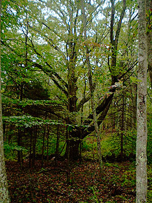
Bradner Preserve is roughly shaped like a basin, sloping down from access points on Hoxsie Road and Gardner Road. The property is a bisected by the Glen Rock Brook, a small trout stream that eventually drains to the Queen/Usquepaugh River to the south east. The woods contain primarily oaks and white pine, with American beech and hickory species. The dry upland understory is made up of huckleberry with some mountain laurel. About 35% of the property is a forested and shrub swamp, providing valuable habitat.
The property was originally owned by the Bradner brothers, who had wanted to develop it into house lots. However, because so much of it is wetlands, it was not economically feasible. Instead the brothers donated the property to the Richmond Rural Preservation Land Trust in 2000.
Hanging Rock Trail leads out to a hanging rock that looks precariously balanced on other rocks. This and other large boulders were left in the area over 10,000 years ago by the continental glaciers that covered New England. The Wolf Tree Trail goes past an ancient white oak that was probably left as a shade tree in an open pasture in the early 1800's. The tree, at least 150 years old, is still in great shape with large spreading limbs. The trail continues along a drumlin, another land feature formed by the glaciers, and crosses a small stream on rocks before joining up with the Hanging Rock Trail.
Sections of the Wolf Tree Trail will be wet in the spring. The stream crossings may be difficult after heavy rains.
Richmond Rural Preservation Land Trust web page
Dogs: Yes. Must be on leash.
Horses: Horses are permitted on all trails except the Wolf Tree Trail.
Other Amenities: There are no restrooms or other amenities.
This is a Creature Challenge site. The creature is on the Yellow 'Wolf Tree' Trail.
Learn more about the Creature Challenge.

Trailhead
Driving Landmarks: From Rt. 138 go north onto Hillsdale Road for 3.3 miles. Take a right onto Hoxsie Road and follow for 1 mile to the intersection with Gardner Road. Take a right onto Gardner. The trailhead is a small clearing on the right, about 2/10 of a mile south of the intersection.
Parking: Yes: Parking lot, 7 spaces, no overnight parking
ADA Accessible Parking Spaces? No
Coordinates: 41° 32.497' N 71° 36.99' W See this location in: Google Maps Acme Maps
KEY:
Trailhead
Only trailheads related to this trail system are shown on this map. To see all trailheads go to the main map.
Do you have comments, corrections or additions to the information about this site?
Help us work together to make this website better by sharing your knowledge!


Private feedback goes to the Blueways Alliance/RI Land Trust Council. We'll use your information to make this website better or pass it along to the people who can deal with physical issues at this site. Public comments are posted here (once they've been reviewed and approved) for all to see.
The data on this website come from many sources, including volunteers and organizations across the state of Rhode Island and nearby parts of Massachusetts. We have done our best to make sure the data are accurate and up to date, but any information critical to the success of your trip should be confirmed before you start. The maps and information on this website should not be substituted for topographic maps or other more detailed maps and guides. We welcome corrections and additions. To send a correction or provide other feedback, please use our feedback form (see link above).
This site report was last updated on September 21, 2023
Comments:
History of Bradner Preserve
Submitted by: Anne Bradner; August 24, 2023; 7:57 pm
Robert Bradner by the Oak Tree. He was thrilled to see the Preserve created and enjoyed!
Photographs:
Photo Credit: Anne Bradner
Nice spot to walk dog, take our small kids
Submitted by: James; March 17, 2018; 7:42 pm
This is a nice small hike that has constant interesting things along the way to keep kids interested. The 8 numbered posts helped our 2 and 4 year olds stay engaged and the hanging rock was a big hit at the end. Not too heavily traveled. Kids, dog, and parents alike enjoyed the walk.
One note of caution: There are a lot of blowdowns to navigate right now because of the series of Nor'Easters that have come through (March 2018). Some of them were pretty difficult to get through.
Rating: