

Welcome to the ExploreRI Mapper
Is This Map too Slow?
This mapping system can be very slow in older web browsers. If this page is not working well for you try not using the water trails button or try the previous version of the mapper. That mapper does not show the water trails, so for information on water trails see the water trails page.
We now show water trails on the ExploreRI mapper!
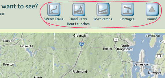
Pick what you want to see by clicking on the buttons below.
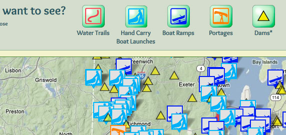
To get more information click on any of the icons that then appear on the map.
![]() More details on how to use the map.
More details on how to use the map.
What do you want to see?
Click on the buttons to choose
Water Trails
Hand Carry Boat Launches
Boat Ramps
Portages
Other Types of Sites
Dams*
Is This Map too Slow?
This mapping system can be very slow in older web browsers. If this page is not working well for you try not using the water trails button or try the previous version of the mapper. That mapper does not show the water trails, so for information on water trails see the water trails page.
*Only some dams are shown, usually those more likely to be of interest to paddlers. Clicking on the dam icons will show the name and height of the dam (where available). The height is measured from the lowest point in the original stream bed to the lowest point on the crest of the dam. Dam heights are not available for dams in Massachusetts.
The data on this website come from many sources, including volunteers and organizations across the state of Rhode Island and nearby parts of Massachusetts. We have done our best to make sure the data are accurate and up to date, but any information critical to the success of your trip should be confirmed before you start. The maps and information on this website should not be substituted for nautical charts, topographic maps, or other more detailed maps and guides. We welcome corrections and additions. To send a correction or provide other feedback, please use our feedback form.
Close
Welcome to the ExploreRI mapping system!
Wondering why the map doesn’t have anything on it? Click on the buttons in the green box just above the map to show what you want to see. For more information see more details on how to use the map at the top of the page.
Credits: The data about access sites and dams came from numerous sources and organizations including Rhode Island Geographic Information System (RIGIS). Much of the access site data was collected through the hard work of volunteers for various conservation, watershed and outdoor recreation groups around the state of Rhode Island.