

 Fry Pond Preserve
West Greenwich, West Greenwich Land Trust

![]() 2.1 miles of trail
2.1 miles of trail
Moderate
Hunting is not allowed here but it is permitted on nearby land. Wear blaze orange during hunting season. More information
Click on the "Trail Map (PDF)" button to download a PDF of the trail map that you can print and take with you on the trail.
Avenza maps are special, free maps that you can use in the Avenza app on your smart phone. These maps let you see your location on the map as you walk. Download the Avenza App for free in the Apple App Store or on Google Play
Click on the Avenza Trail Map button to "purchase" the free map for this trail from the Avenza map store. If this is your first time, Avenza will ask you to set up an account to check out. However, all Avenza trail maps listed on ExploreRI are free.
In Rhode Island the primary hunting seasons typically run from the second Saturday in September to the last day of February and from the third Saturday in April to the last day in May, however this can vary from year to year and depends on what game is being hunted. During hunting season you should wear at least 200 square inches (a hat OR a vest) of blaze orange. During shotgun deer season, which is typically in December, you should wear at least 500 square inches of blaze orange (a hat AND a vest). For more information see the RI DEM website.
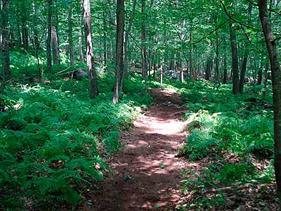
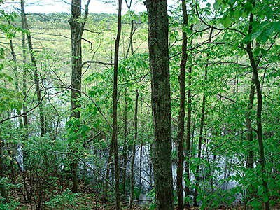
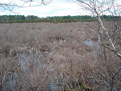


The Fry Pond Preserve is owned and managed by the West Greenwich Land Trust. The trail into the preserve starts immediately behind the West Greenwich Town Hall and winds down a hill to a loop trail that offers excellent views of the Fry Pond wetland. A second trail branches off from the access trail and winds through the upland of this rugged and rocky property before connecting to the loop trail.
West Greenwich Land Trust website
Dogs: Yes. Dogs must be on leashes and owners must pick up waste.
This is a Creature Challenge site. The creature is on the Fry Pond Loop Trail.
Learn more about the Creature Challenge.

Trailhead
Driving Landmarks: The trailhead is immediately behind the West Greenwich Town Hall/Police Station, which is at 280 Victory Highway (route 102). The trail starts from the area of the basketball court by the trailhead kiosk.
Parking: Yes: Parking lot, 25 spaces, no overnight parking
ADA Accessible Parking Spaces? No
Coordinates: 41° 38.417' N 71° 41.254' W See this location in: Google Maps Acme Maps
KEY:
Trailhead
Only trailheads related to this trail system are shown on this map. To see all trailheads go to the main map.
Do you have comments, corrections or additions to the information about this site?
Help us work together to make this website better by sharing your knowledge!


Private feedback goes to the Blueways Alliance/RI Land Trust Council. We'll use your information to make this website better or pass it along to the people who can deal with physical issues at this site. Public comments are posted here (once they've been reviewed and approved) for all to see.
The data on this website come from many sources, including volunteers and organizations across the state of Rhode Island and nearby parts of Massachusetts. We have done our best to make sure the data are accurate and up to date, but any information critical to the success of your trip should be confirmed before you start. The maps and information on this website should not be substituted for topographic maps or other more detailed maps and guides. We welcome corrections and additions. To send a correction or provide other feedback, please use our feedback form (see link above).
This site report was last updated on September 21, 2023
Comments:
Fry Pond May 2022
Submitted by: Pat; May 9, 2022; 11:42 am
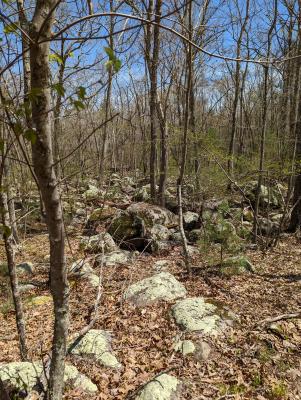
Hiked the hillside and loop on Sunday May 8, 2022. It was a moderately strenuous hike on the hillside with narrow, rocky, leaf covered trails. I recommend hiking boots for this one. Tons of low bush blueberries and some areas with mountain laurel. Once the underbrush leafs out, some of the trail may be quite overgrown and difficult to follow. Hiked down along the loop trail by the pond. This is 85 - 90% filled in with plant growth. Interesting areas with large boulders. Don't think I would hike it again except to visit during blueberry season. :)
Rating:
Photographs:
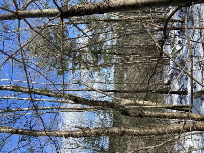
Photo Credit: Pat
Photo Credit: Pat
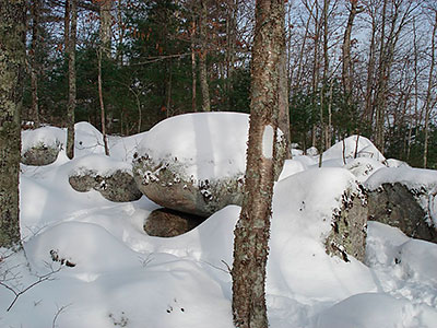
Fun in the winter!
Submitted by: Tim Pittman; February 6, 2022; 1:46 pm
Easy to follow, informative, and beautiful.
Rating:
Photographs:
Photo Credit: Tim Pittman
Photo Credit: Tim Pittman
Update/Correction for Trailhead
Submitted by: Louis; March 31, 2018; 11:19 pm
Trailhead is behind the Police Station (not the Town Hall)
Rating: