

 Hunts Mills
East Providence, City of East Providence

![]() 0.8 miles of trail
0.8 miles of trail
Easy
Click on the "Trail Map (PDF)" button to download a PDF of the trail map that you can print and take with you on the trail.
Avenza maps are special, free maps that you can use in the Avenza app on your smart phone. These maps let you see your location on the map as you walk. Download the Avenza App for free in the Apple App Store or on Google Play
Click on the Avenza Trail Map button to "purchase" the free map for this trail from the Avenza map store. If this is your first time, Avenza will ask you to set up an account to check out. However, all Avenza trail maps listed on ExploreRI are free.
In Rhode Island the primary hunting seasons typically run from the second Saturday in September to the last day of February and from the third Saturday in April to the last day in May, however this can vary from year to year and depends on what game is being hunted. During hunting season you should wear at least 200 square inches (a hat OR a vest) of blaze orange. During shotgun deer season, which is typically in December, you should wear at least 500 square inches of blaze orange (a hat AND a vest). For more information see the RI DEM website.
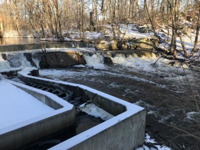


The trail starts near the small parking area by the gazebo just to the right of the Hunt House. The red blazed trail first leads down a small set of stone stairs then winds through an area known as the Terrace Garden. At different times of year there will be different shrubs and flowers in bloom here including mountain laurel. The red blazed trail then turns right into a short section of woods before crossing an access road. The trail then continues straight in the woods meandering slightly downhill toward the Ten Mile River. At the next trail blaze post, the red blazed trail turns to the left. Here on the right is a spot known as Sunset Rock. It tends to be a little overgrown in the summer months, but it offers a good view of the river the rest of the year. Continuing following the red blazed trail will lead you to the next set of trail blaze posts. Again at the river's edge is another spot to view the river. This spot is known as Otter Rock as there have been sightings of otters at this point. When the water levels are low on the river you will find inscriptions from the early 1900's on the rocks. The red blazed trail then leads south passing a chain link fence into the former fire department training area. You will soon see the remnants of the facility including the old fire tower that was used for training and an old tanker. The trail then passes the chain link fence again to the next trail blaze post. Turning right here will lead you to the large grass area behind the Hunt House. In this area behind the house there is a circle of granite blocks. These blocks represent where the carousel of the amusement park once stood. You then walk toward the gate between the house and the large stone building that was once the pump house (built in 1893) for the water department to the final highlight of the hike. The Hunts Mills Dam and waterfall. From here you then follow the road in front of the Hunt House to the point of beginning.
Hiking blog featuring East Providence properties
Dogs: Yes. Dogs must be on leashes and owners must pick up waste.
Other Amenities: The John Hunt House is home to the East Providence Historical Society. The house is open to the public from March to December on the second Sunday of those months.
This is a Creature Challenge site. The creature is on the Red Trail.
Learn more about the Creature Challenge.

Hunts Mills Trailhead
Driving Landmarks: Trailhead is adjacent to a gazebo on the grounds of the historic John Hunt House off of Pleasant Street (RI Route 114 A) in the Rumford section of East Providence. The entrance road is on the right 0.2 miles south of the intersection of Route 114 (Pawtucket Avenue) and Route 114A (Pleasant Street).
Parking: Yes: Parking lot, 6 spaces, no overnight parking
ADA Accessible Parking Spaces? No
Coordinates: 41° 49.697' N 71° 20.753' W See this location in: Google Maps Acme Maps
KEY:
Trailhead
Only trailheads related to this trail system are shown on this map. To see all trailheads go to the main map.
Do you have comments, corrections or additions to the information about this site?
Help us work together to make this website better by sharing your knowledge!


Private feedback goes to the Blueways Alliance/RI Land Trust Council. We'll use your information to make this website better or pass it along to the people who can deal with physical issues at this site. Public comments are posted here (once they've been reviewed and approved) for all to see.
The data on this website come from many sources, including volunteers and organizations across the state of Rhode Island and nearby parts of Massachusetts. We have done our best to make sure the data are accurate and up to date, but any information critical to the success of your trip should be confirmed before you start. The maps and information on this website should not be substituted for topographic maps or other more detailed maps and guides. We welcome corrections and additions. To send a correction or provide other feedback, please use our feedback form (see link above).
This site report was last updated on September 21, 2023
Comments:
Very beautiful with waterfall
Submitted by: Mary ST. ; September 17, 2024; 10:35 am
Beautiful rushing water starts you off into a journey of beauty and history combined.
Rating:
Photographs:
Photo Credit: Mary ST.
Photo Credit: Mary ST.
Photo Credit: Mary ST.
Beautiful trail
Submitted by: Anonymous; March 8, 2023; 6:00 pm
My kids and I love coming here for picnics and walks in through the trails
Rating:
Photographs:
I love this place
Submitted by: Augusto; March 8, 2023; 5:52 pm
The place is awesome because the tp. The duck are cool
Rating:
Photographs:
Photo Credit: Augusto
Seasons
Submitted by: AS Kemp ; February 28, 2022; 9:38 am
A great review of our trail at Hunt's Mill... Thanks for visiting!
Rating:
Photographs:
Photo Credit: AS Kemp
Beautiful, tranquil short hike !
Submitted by: Anonymous; February 9, 2022; 9:26 pm
Photographs:
Wonderful wooded spot with surprises along the way
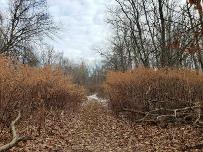
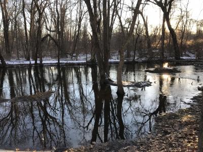
Submitted by: RC; January 13, 2022; 5:52 pm
Rating:
Photographs:
Photo Credit: RC
Photo Credit: RC