

Walking Trails and Water Trails now on ExploreRI.org
We've made some big changes to ExploreRI.org in recent months! The website now has details on over 40 walking trails and 20 water trails all across Rhode Island. Walking trails and mapped water trails were both part of the original vision for ExploreRI, but it's taken six years to get here.
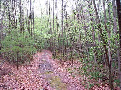
The loop trail at Sprague Farm in Glocester
While we talked about "water trails" from the start, for its first six years ExploreRI was really just a list of places to launch canoes, kayaks and other boats. Those put-ins, and there are over 200 of them on ExploreRI, could be connected to make a route, but there was nothing on the site beyond text descriptions to actually show you the route. Last fall we rolled out a series of 22 new water trail maps: paddling routes all across the state, in saltwater and fresh, on rivers, lakes and ponds; with route descriptions, safety information and often historical and ecological insights into the area. The water trail maps can be downloaded in Adobe Acrobat format and printed to take with you on your next paddling outing. The water trails are also shown as route lines on the Google mapsbased mapping system on the website, so you can see where they are and where they go.
The walking trails on ExploreRI are all on either land trust or Audubon Society of Rhode Island properties. These trails will take you to some of the least known, most beautiful places in Rhode Island, and there are trails to appeal to every taste. The steep, often rocky trails around Long Pond and Ell Pond in Hopkinton show you Rhode Island's only designated National Natural Landmark. High cliffs overlook Long Pond, the woods are filled with rhododendrons that bloom in early June, and the forest contains some of the largest Eastern hemlock trees in the state. The network of trails here takes you through properties owned by the Audubon Society of Rhode Island, The Nature Conservancy, and RI DEM.
On the other side of the state, Veterans Memorial Park, in the heart of Barrington, has walking trails around scenic Brickyard Pond. When the herring are running in the spring ospreys and even sometimes bald eagles fish in the pond, and in the evening the spring peepers are in full chorus. In the summer there are dragonflies and the sweet fragrance of native summersweet (clethra). In the evening you may here the calls of great horned owls.
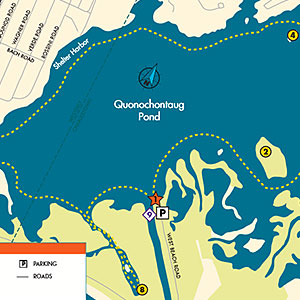
A detail of the Quonochontaug Pond water trail map. For the full map and many more water trail maps, see the Water Trails page.
Other walking trails listed on ExploreRI take you through coastal marshes and old forests, and past old farmsteads, now marked only by stone walls snaking through the woods, and the remains of farmhouse and barn foundations, where families once lived and raised animals and harvested crops. Some trails are short and easy, others are more challenging and long enough for an all day trip. No matter where you are in the state, there's a trail within 20 minutes of you.
The new paddling trails on ExploreRI are as diverse as the walking trails. Most are fresh water paddles, but four are on the tidal salt ponds of South County. The inlets to the salt ponds, where they connect to the ocean, are commonly dangerous places, with strong currents and steep surf, but the paddle trails are designed to avoid these areas and take you through the peaceful waters of the salt ponds, where birds and other wildlife abound; a great way to enjoy one of Rhode Island's special environments.
If your tastes are more urban you can follow the Lower Woonasquatucket River Water Trail through the middle of Providence and see the city from a new angle, or paddle the lower Pawtuxet River, where at high tide you can paddle from the bay up into the river, passing the site of a dam that blocked both paddlers and fish from making this passage for over 300 years, until the dam was removed in the summer of 2011.
So, check out ExplorRI.org and then get out and explore Rhode Island's beautiful land and water trails!
This article was originally published (in a modified form) in the Spring/Summer 2013 edition of Trail Mix, the Newsletter of The Greenways Alliance of Rhode Island. RI Blueways thanks the Greenways Alliance for giving us permission to republish this articles