

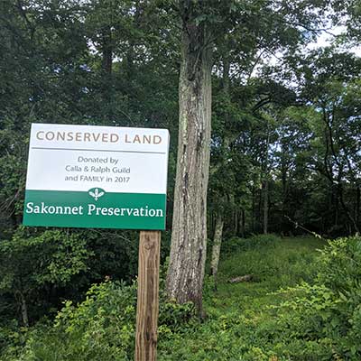
 The Guild Property at Grays Mill Pond
Little Compton, Sakonnet Preservation Association

![]() 0.4 miles of trail
0.4 miles of trail
Moderate
Click on the "Trail Map (PDF)" button to download a PDF of the trail map that you can print and take with you on the trail.
Avenza maps are special, free maps that you can use in the Avenza app on your smart phone. These maps let you see your location on the map as you walk. Download the Avenza App for free in the Apple App Store or on Google Play
Click on the Avenza Trail Map button to "purchase" the free map for this trail from the Avenza map store. If this is your first time, Avenza will ask you to set up an account to check out. However, all Avenza trail maps listed on ExploreRI are free.
In Rhode Island the primary hunting seasons typically run from the second Saturday in September to the last day of February and from the third Saturday in April to the last day in May, however this can vary from year to year and depends on what game is being hunted. During hunting season you should wear at least 200 square inches (a hat OR a vest) of blaze orange. During shotgun deer season, which is typically in December, you should wear at least 500 square inches of blaze orange (a hat AND a vest). For more information see the RI DEM website.
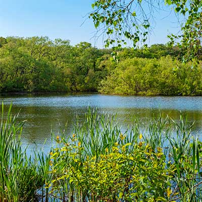
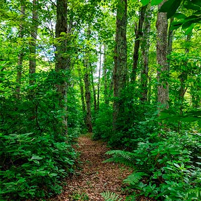
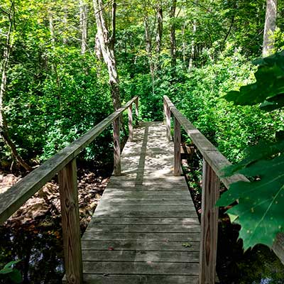

The property is located on the border of Rhode Island and Massachusetts in the historic village of Adamsville. The parking area is next to the pond on the north side of Adamsville Road. At the back side of the parking area is a post and rail fence with a gate. Enter through the gate and follow the brush line up a small hill after passing the small structures on the right. At the top of the hill is a sign at the entrance of the preserve. Just beyond the sign a trail appears downhill and to the left that leads to a footbridge that crosses the Adamsville Brook. Just after the bridge, the path splits three ways to take you through the two loops of trails.
The trail is a little root bound and can be muddy in spots. We don't recommend walking the trail in the wet Spring months since the brook can sometimes flood. Stones in the path create uneven terrain in some areas. Beautiful ephemerals can be found in the spring and a variety of birds stop by in the fall. The property is small and the trail is short, but the brook and nearby pond make for peaceful stops. Ferns, moss, a giant holly tree, and the sounds of the bubbling Adamsville Brook make this property a magical place to walk.

Grays Mill Pond Trailhead
Driving Landmarks: The parking area at the trailhead is on the other side of the street and about 250 feet up the street from Gray's Daily Grind and Gray's Grist Mill on Adamsville Road. If you are driving from Rhode Island east into Massachusetts go past the cafe and then look for the parking lot on the left just after the end of the pond.
Parking: Yes: Parking lot, no overnight parking
Coordinates: 41° 33.359' N 71° 7.615' W See this location in: Google Maps Acme Maps
KEY:
Trailhead
Only trailheads related to this trail system are shown on this map. To see all trailheads go to the main map.
Do you have comments, corrections or additions to the information about this site?
Help us work together to make this website better by sharing your knowledge!

Private feedback goes to the Blueways Alliance/RI Land Trust Council. We'll use your information to make this website better or pass it along to the people who can deal with physical issues at this site. Public comments are posted here (once they've been reviewed and approved) for all to see.
The data on this website come from many sources, including volunteers and organizations across the state of Rhode Island and nearby parts of Massachusetts. We have done our best to make sure the data are accurate and up to date, but any information critical to the success of your trip should be confirmed before you start. The maps and information on this website should not be substituted for topographic maps or other more detailed maps and guides. We welcome corrections and additions. To send a correction or provide other feedback, please use our feedback form (see link above).
This site report was last updated on November 19, 2020