

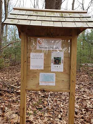
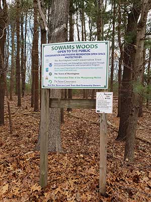
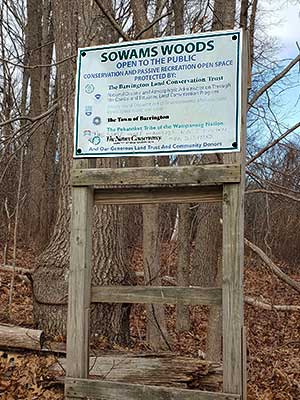
 Sowams Woods
Barrington, Barrington Land Conservation Trust

![]() 0.8 miles of trail
0.8 miles of trail
Easy
Click on the "Trail Map (PDF)" button to download a PDF of the trail map that you can print and take with you on the trail.
Avenza maps are special, free maps that you can use in the Avenza app on your smart phone. These maps let you see your location on the map as you walk. Download the Avenza App for free in the Apple App Store or on Google Play
Click on the Avenza Trail Map button to "purchase" the free map for this trail from the Avenza map store. If this is your first time, Avenza will ask you to set up an account to check out. However, all Avenza trail maps listed on ExploreRI are free.
In Rhode Island the primary hunting seasons typically run from the second Saturday in September to the last day of February and from the third Saturday in April to the last day in May, however this can vary from year to year and depends on what game is being hunted. During hunting season you should wear at least 200 square inches (a hat OR a vest) of blaze orange. During shotgun deer season, which is typically in December, you should wear at least 500 square inches of blaze orange (a hat AND a vest). For more information see the RI DEM website.
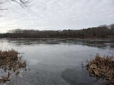
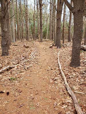
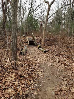
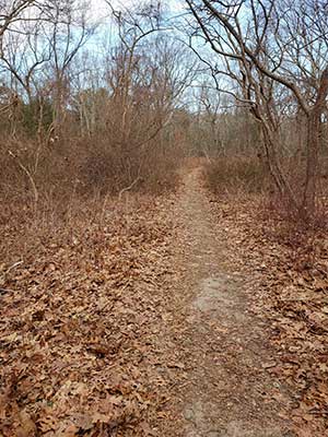

Seven short, blazed trails wind through the 7.5 acre Sowams Woods property. The trails are fairly flat but do have occasional fallen trees across them and there are wooden steps in some places. The purple trail runs along the ridge beside Echo Lake and often has great springtime views of osprey diving for fish in the lake. Multiple types of birds can be seen through the seasons. On the yellow blazed trails there are two vernal pools that are home to spring peepers, wood frogs, fairy shrimp and spotted salamanders. You may spot deer as they walk through the pine, oak and holly-filled woods.
Dogs: Dogs must be leashed and picked up after at ALL times.
This is a Creature Challenge site. The creature is on the Purple Trail.
Learn more about the Creature Challenge.

Washington Road Trailhead
Driving Landmarks: The trailhead is on Washington Street but note that there is no parking on Washington Street. You can park nearby along Spinnaker Drive, Lighthouse Lane, or Tallwood Drive.
Parking: Yes: On street, no overnight parking
ADA Accessible Parking Spaces? No
Coordinates: 41° 43.983' N 71° 20.227' W See this location in: Google Maps Acme Maps
South Lake Drive Trailhead
Driving Landmarks: This trailhead is on the north side of South Lake Drive, 100 yards from the intersection with Washington Road. Note that South Lake Drive is one way from Washington Street to Middle Highway. It is also in poor condition and may at some point be closed.
Parking: Yes: Parking lot, 2 spaces, no overnight parking
ADA Accessible Parking Spaces? No
Coordinates: 41° 43.974' N 71° 20.117' W See this location in: Google Maps Acme Maps
From the East Bay Bicycle Path: turn south on Washington Road. Sowams Woods will be on the left in 1/2 a mile.
KEY:
Trailhead
Only trailheads related to this trail system are shown on this map. To see all trailheads go to the main map.
Do you have comments, corrections or additions to the information about this site?
Help us work together to make this website better by sharing your knowledge!

Private feedback goes to the Blueways Alliance/RI Land Trust Council. We'll use your information to make this website better or pass it along to the people who can deal with physical issues at this site. Public comments are posted here (once they've been reviewed and approved) for all to see.
The data on this website come from many sources, including volunteers and organizations across the state of Rhode Island and nearby parts of Massachusetts. We have done our best to make sure the data are accurate and up to date, but any information critical to the success of your trip should be confirmed before you start. The maps and information on this website should not be substituted for topographic maps or other more detailed maps and guides. We welcome corrections and additions. To send a correction or provide other feedback, please use our feedback form (see link above).
This site report was last updated on September 21, 2023