

 Steere Hill Farm Conservation Area
Glocester, Glocester Land Trust

![]() 6.0 miles of trail
6.0 miles of trail
Moderate
Click on the "Trail Map (PDF)" button to download a PDF of the trail map that you can print and take with you on the trail.
Avenza maps are special, free maps that you can use in the Avenza app on your smart phone. These maps let you see your location on the map as you walk. Download the Avenza App for free in the Apple App Store or on Google Play
Click on the Avenza Trail Map button to "purchase" the free map for this trail from the Avenza map store. If this is your first time, Avenza will ask you to set up an account to check out. However, all Avenza trail maps listed on ExploreRI are free.
In Rhode Island the primary hunting seasons typically run from the second Saturday in September to the last day of February and from the third Saturday in April to the last day in May, however this can vary from year to year and depends on what game is being hunted. During hunting season you should wear at least 200 square inches (a hat OR a vest) of blaze orange. During shotgun deer season, which is typically in December, you should wear at least 500 square inches of blaze orange (a hat AND a vest). For more information see the RI DEM website.
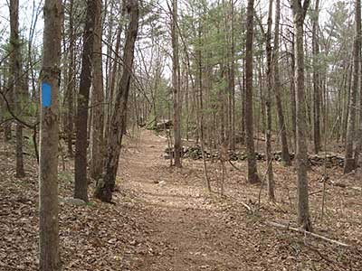
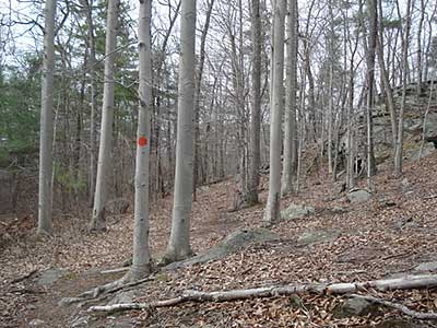


Steere Hill is the largest of four abutting protected open space properties totaling over 447 acres. In this conserved area are also Phillips Farm, LePlat Woodland, and Heritage Park. Within this area are over seven miles of wide dirt/gravel roads and narrower foot paths created by the Town of Glocester and the Glocester Land Trust. Most trails have a gentle slope and visit scenic ledge vistas, vernal pools and wetlands, stands of American Beech, two large fields, miles of stone walls, trout streams, and stone foundation walls for barns and farmhouses.
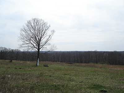
The lower elevation of Steere Hill nearest to the parking area was the former Angell Farm and remnants of the silos, barn foundations and gates are still visible. The summit of Steere Hill was a vast orchard of apples, peaches, and pears. The orchard closed in 1963 and the land became overgrown with invasive plants such as Oriental Bittersweet, Japanese Barberry, Autumn Olive, and Multiflora Rose. Soon after the GLT acquired Steere Hill, and with assistance from the USDA Natural Resources Conservation Service, it cleared much of the former orchard of the invasive plants and created a field of native grasses and wildflowers. This created a wildlife habitat needed by ground nesting birds and mammals, such as bobolinks, meadowlarks, woodcocks, bluebirds, owls, New England Cottontail Rabbits, and butterflies. The invasive plants killed most of the fruit trees, but a few apple trees remain and produce fruit which is very popular with the deer population.
Phillips Farm was once an orchard, but converted to a dairy farm. Remnants of the farming activity, such as old wagon wheels, manure spreader, and hay baler, can be seen along the trails. As on Steere Hill, the fields of Phillips Farm are left unmowed during the summer to allow ground nesting birds to breed.
In 1967 the Town of Glocester acquired the land for Heritage Park and created wide walking paths. In 1990 the newly formed Glocester Land Trust acquired Phillips Farm, which was a half mile from Heritage Park. When the Steere Hill property was acquired in 2002 it connected Heritage Park to Phillips Farm, followed by LePlat Woodland in 2010. Acquisition funding was from a combination of Town of Glocester Open Space Bonds, RI DEM Open Space Bonds, The Nature Conservancy, Champlain Foundations, and private contributions.
Steere Hill is open year round from sunrise to sunset. During the winter months it is open for snowshoeing and cross country skiing. In warm weather Steere Hill is a popular place for horseback riding, jogging, geocaching, dog walks, and casual walks.
Dogs: Yes: must be under owners control (voice or leash). Remove/knock waste off trail.
Horses: Yes: To minimize erosion, no riding for 48 hours after heavy rain.
Bicycles: Yes: only on wide gravel trails. To minimize erosion, no riding for 48 hours after heavy rain.
Other Amenities: In the summer there is a portable toilet as well as picnic tables at the summit of Steere Hill. In the winter the portable toilet is moved to the Putnam Pike trailhead.

Steere Hill Trailhead
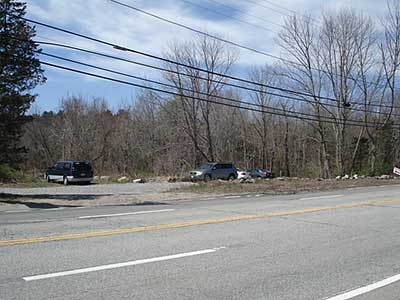
Driving Landmarks: The parking lot for this trailhead is across from 383 Putnam Pike (Route 44) in Glocester, just east of the Harmony Post Office. The parking lot and trailhead are on the south side of the road (the right side if you are heading towards Providence).
Parking: Yes: Parking lot, 15 spaces, no overnight parking
ADA Accessible Parking Spaces? No
Coordinates: 41° 53.64' N 71° 36.65' W See this location in: Google Maps Acme Maps
Heritage Park Trailhead
Driving Landmarks: The parking lot for this trailhead is across from 57 Chestnut Oak Road, Glocester, about 0.4 miles south on Chestnut Oak Road from Route 44 (Putnam Pike). The parking lot and trailhead are on the left if you are headed south (away from Route 44) on Chestnut Oak Road.
Parking: Yes: Parking lot, 20 spaces, no overnight parking
ADA Accessible Parking Spaces? No
Coordinates: 41° 53.53' N 71° 37.93' W See this location in: Google Maps Acme Maps
KEY:
Trailhead
Only trailheads related to this trail system are shown on this map. To see all trailheads go to the main map.
Do you have comments, corrections or additions to the information about this site?
Help us work together to make this website better by sharing your knowledge!


Private feedback goes to the Blueways Alliance/RI Land Trust Council. We'll use your information to make this website better or pass it along to the people who can deal with physical issues at this site. Public comments are posted here (once they've been reviewed and approved) for all to see.
The data on this website come from many sources, including volunteers and organizations across the state of Rhode Island and nearby parts of Massachusetts. We have done our best to make sure the data are accurate and up to date, but any information critical to the success of your trip should be confirmed before you start. The maps and information on this website should not be substituted for topographic maps or other more detailed maps and guides. We welcome corrections and additions. To send a correction or provide other feedback, please use our feedback form (see link above).
This site report was last updated on February 27, 2019
Comments:
Beautiful place
Submitted by: Anonymous; May 21, 2022; 2:56 pm
The main path is broad and level enough for strollers or wheelchairs, though some of the side trails are not fully accessible. Wonderful views that change dramatically as you walk. Lots of wildlife- our favorites from today included a tanager and a tiny toad right in the middle of the path. Thank you for preserving this treasure!
Rating:
Awesome Experience
Submitted by: Anonymous; April 17, 2017; 6:12 pm
Steere Hill Farm conservation Hiking Trails are clean and well marked. I would rank them as easy to navigate and hike.
I will definitely return to explore
Rating: