

 Oakland Forest & Meadow Preserve
Portsmouth, Aquidneck Land Trust

![]() 0.6 miles of trail
0.6 miles of trail
Easy
Click on the "Trail Map (PDF)" button to download a PDF of the trail map that you can print and take with you on the trail.
Avenza maps are special, free maps that you can use in the Avenza app on your smart phone. These maps let you see your location on the map as you walk. Download the Avenza App for free in the Apple App Store or on Google Play
Click on the Avenza Trail Map button to "purchase" the free map for this trail from the Avenza map store. If this is your first time, Avenza will ask you to set up an account to check out. However, all Avenza trail maps listed on ExploreRI are free.
In Rhode Island the primary hunting seasons typically run from the second Saturday in September to the last day of February and from the third Saturday in April to the last day in May, however this can vary from year to year and depends on what game is being hunted. During hunting season you should wear at least 200 square inches (a hat OR a vest) of blaze orange. During shotgun deer season, which is typically in December, you should wear at least 500 square inches of blaze orange (a hat AND a vest). For more information see the RI DEM website.


Due to mass die-off of large beech trees from Beech Leaf Disease, the loop through the beech forest is currently closed. Many of the beech trees are dead and/or severely diseased along the trail and may pose safety hazards to hikers. The red trail in the map below is the trail that has been closed.
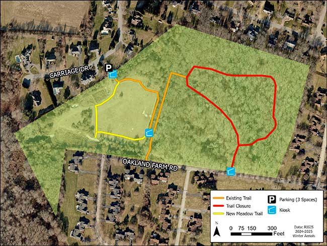
The forest loop will remain closed until the Aquidneck Land Trust is able to do the necessary tree work to improve conditions for hikers. The meadow trail has been extended and remains open. For more info call the Aquidneck Land Trust at 401-849-2799 or email info@ailt.org. The description below has NOT yet been updated to reflect this closure.
Oakland Forest & Meadow Preserve was conserved in 2000, a grassroots effort to protect the land, including the old growth beech forest from being developed into condominiums. The trail starts at a small bridge surrounded by pussy willows, crossing over a freshwater wetland. The trail then winds around the edge of the meadow and then crosses over another footbridge into the forest area. Follow the trail left for approximately 0.1 miles. At this point, you can follow the approximately 0.5 mile loop trail in either direction around the heart of the old growth forest, which contains beech and oak trees well over 250 years old. The forest is one of the healthiest examples of remaining old growth American beech (Fagus grandifolia). Though the preserve was never logged, it served as a "gentleman's" farm for generations, passing through the Channing/Gibbs, Vanderbuilt, and Young families. The band of rhododendron that runs through the forest is a remnant planting from one of the former estates. The forest, meadow, wetlands, and ponds onsite support numerous plant and wildlife species, including turkeys, coyotes, passerine birds, hawks, woodpeckers, and waterfowl. The trail may be wet in early spring, and you may encounter ticks and poison ivy, so please dress accordingly.
Other Amenities: There is a bicycle rack at the trailhead. Remember, bicycles are not allowed on the trails.

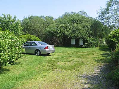
Carriage Drive Trailhead
Driving Landmarks: Turn on to Union St. at the light on East Main Rd. in Portsmouth. Take your first left onto Carriage Drive. The road bends sharply to the right at approximately 0.1 miles. Comtinue to follow Carriage Dr. for approximately 0.4 miles to a small parking lot on your left. The there are several bushes in the parking lot area, and houses on either side. If you reach the end of Carriage Dr., you have gone approximately 0.1 miles too far.
Parking: Yes: Parking lot, 3 spaces, no overnight parking
ADA Accessible Parking Spaces? No
Coordinates: 41° 33.41' N 71° 15.815' W See this location in: Google Maps Acme Maps
Take Bus 60 to Union Street in Portsmouth. Walk northwest on Union Street toward Carriage Drive. Turn Left on Carriage Drive. The road bends sharply to the right at approximately 0.1 miles. Continue to follow Carriage Dr. for approximately 0.4 miles to a small parking lot on your left. The there are several bushes in the parking lot area, and houses on either side. If you reach the end of Carriage Dr., you have gone approximately 0.1 miles too far. Note: There are not sidewalks on this route.
KEY:
Trailhead
Only trailheads related to this trail system are shown on this map. To see all trailheads go to the main map.
Do you have comments, corrections or additions to the information about this site?
Help us work together to make this website better by sharing your knowledge!


Private feedback goes to the Blueways Alliance/RI Land Trust Council. We'll use your information to make this website better or pass it along to the people who can deal with physical issues at this site. Public comments are posted here (once they've been reviewed and approved) for all to see.
The data on this website come from many sources, including volunteers and organizations across the state of Rhode Island and nearby parts of Massachusetts. We have done our best to make sure the data are accurate and up to date, but any information critical to the success of your trip should be confirmed before you start. The maps and information on this website should not be substituted for topographic maps or other more detailed maps and guides. We welcome corrections and additions. To send a correction or provide other feedback, please use our feedback form (see link above).
This site report was last updated on August 1, 2025
Comments:
The Magical Trail
Submitted by: Mary ST. ; September 17, 2024; 10:23 am
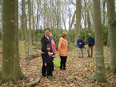
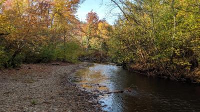
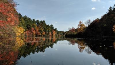
Beautifully magical with it's gorgeous flowers, butterflies, and wonderfully big mushrooms.
Rating:
Photographs:
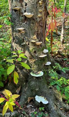
Photo Credit: Mary ST.
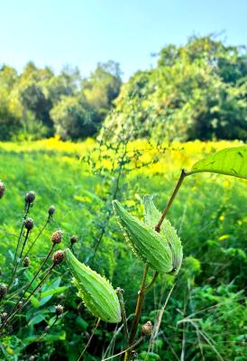
Photo Credit: Mary ST.
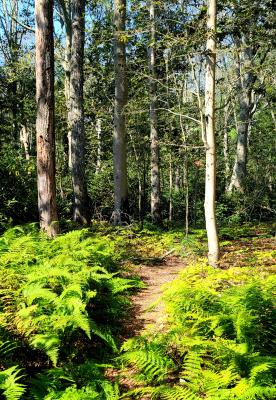
Photo Credit: Mary ST.
Pleasant walk
Submitted by: Robb S; August 23, 2024; 5:37 pm
This was a very pleasant walk. Easy terrain fairly well groomed. Watch out for roots!
Rating: