 Sakonnet Greenway Trail
Portsmouth, Middletown, Aquidneck Land Trust
![]() 10.0 miles of trail
10.0 miles of trail
Moderate
Click on the "Trail Map (PDF)" button to download a PDF of the trail map that you can print and take with you on the trail.
Avenza maps are special, free maps that you can use in the Avenza app on your smart phone. These maps let you see your location on the map as you walk. Download the Avenza App for free in the Apple App Store or on Google Play
Click on the Avenza Trail Map button to "purchase" the free map for this trail from the Avenza map store. If this is your first time, Avenza will ask you to set up an account to check out. However, all Avenza trail maps listed on ExploreRI are free.
In Rhode Island the primary hunting seasons typically run from the second Saturday in September to the last day of February and from the third Saturday in April to the last day in May, however this can vary from year to year and depends on what game is being hunted. During hunting season you should wear at least 200 square inches (a hat OR a vest) of blaze orange. During shotgun deer season, which is typically in December, you should wear at least 500 square inches of blaze orange (a hat AND a vest). For more information see the RI DEM website.

The Aquidneck Land Trust has been working with landowners over many years to create trail easements through the Sakonnet Greenway, in Portsmouth and Middletown. The final section of the Sakonnet Greenway Trail was completed in October, 2012, making it the longest nature trail on Aquidneck Island. The Sakonnet Greenway Trail passes through recreational areas, active farmland, wetlands, and forest.
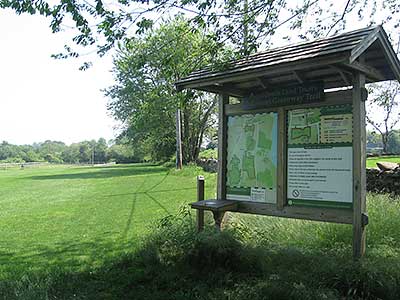
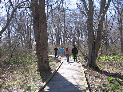
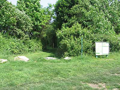
Starting from the Glen in Portsmouth, the trail heads south between the stone wall, and polo fields, and along the wetland edge near Pennfield School (0.3 miles). The trail then crosses over Sandy Point Ave., and does a loop around the corn and cattle fields ( Portsmouth Loop Trail, 1.6 miles). It continues south through a red maple, black gum swamp. This scenic section of the trail has two bridges and a raised boardwalk that cross over the wetland. The trail exits the forest and continues along a hedgerow. The trail then turns to the right and parallels Braman's Lane for a short distance before the kiosk (2.5). The trail then crosses Braman's Lane at the crosswalk near the kiosk and extends west along the field along Braman's Lane (2.8). Turn and follow the stone wall to the section of trail that runs along the perimeter of Newport National Golf Course (4.8).
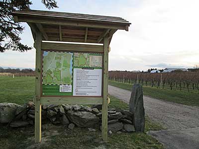
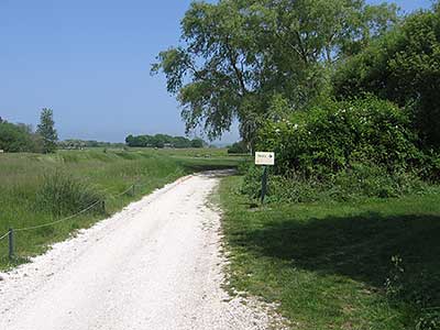
You can continue on the new section of the trail by crossing over Mitchell's Lane and walking approximately 0.1 miles along Mitchell's Lane. Turn right at the kiosk (parking also available here) and follow the trail along the farm road for approximately 0.1 miles. At this point, you arrive at the Middletown Southern Loop trail. If you follow the loop to the left, you cross through a cornfield, along a hedgerow, and through a meadow and walk the perimeter of the Wyatt Road Soccer Complex (0.8 miles). Parking is also available at the Soccer Complex. Continue along a hedgerow on Wyatt road on a trail lined with woodchips, then turn right along the farm road. Note that this is the boundary with Newport Rifle Club and you may hear load noises. Follow the raised gravel path through the wetland. You will see a small pond to your left. Continue to follow the trail along the gravel path and turn left to cross over the Maidford River on a raised timber walkway. Continue through meadow, past a barn owl box on a post, and turn right along the farm road through Newport Vineyards. Parking is also available at Newport Vineyards (1.7). Follow the trail past the picnic area and pond at Newport Vineyards and turn to the left, paralleling Meadow Lane. The trail opens up into farm land at this point and you can follow the Middletown Northern Loop or continue on the Middletown southern loop on a farm road through a wooded wetland. Turn right on a windy gravel pathway through a maple grove, turn left to continue along the trail and turn right through a wood-chip lined path through a juniper grove to finish the Middletown Southern Loop (2.7) .
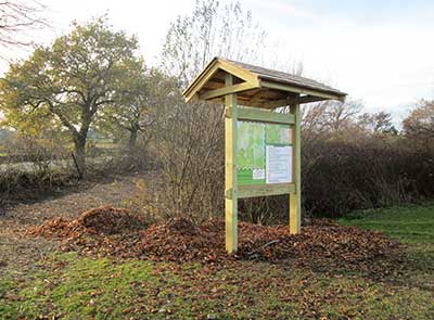
The Northern Loop Trail can be accessed from the Southern Loop Trail or from parking at Albro woods. From the Albro Woods Parking, follow the Albro Woods trail closest to the parking area approximately 0.1 miles. Turn right and follow the Albro Woods Trail approximately 0.1 miles to the Sakonnet Greenway Trail Kiosk. At this point you have arrived at the Middletown Northern LoopTrail. You can follow the Middletown Northern Loop Trail to the left and follow the trail along the edge of Albro Woods and farm fields (0.3). Turn right along Mitchell's Lane and follow the raised gravel walkway (0.4). Turn right to follow the edge of the farm field. Take two lefts and a right to follow along the field/woods hedgerow (0.8). At this point you intersect with the Middletown Southern Loop and a 0.2 mile section of trail to the left that takes you back to the Albro Woods kiosk. You can also continue to the left along a farm road to complete the Middletown Northern Loop. Turn to the left and continue along the field and the edge of the driveway (1.1). Turn right along East Main Road and right again along the perimeter of Boulevard Nurseries (1.3). Take two more lefts along the farm road around the perimeter of Boulevard nurseries. Then turn right along East Main Road and right along the hedgerow to arrive back at the Albro Woods kiosk (1.7).
Note: The northern section of the trail is NOT a loop, so please plan accordingly. The southern section of the trail has many loops to choose from and can be confusing. The trail is marked with yellow and black arrows, we suggest you also print and bring a trail map for your convenience (trail maps are also posted on all of the kiosks and available in the kiost at The Glen). You may encounter ticks, poison ivy, and wet areas. Trail closed for mud season (mid-March to Mid-April). You may hear loud noises near the Newport Rifle Club on the Southern Loop Trail. Please stay away from operating farm equipment. Enjoy!
Dogs: Yes. Dogs must be on leashes and owners must pick up waste.
Horses: Horses are permitted on the trail except for the wooded section from the Portsmouth Loop Trail to Braman's Lane. The section of the trail from The Glen to Pennfield School may be closed to horses when the ground is wet or school is in session (see map).
Other Amenities: There are several benches along the trail. Picnic tables are available at Newport Vineyards. Farmer's Markets occur here on Saturday mornings spring-fall.
The Glen/Linden Lane Trailhead
Driving Landmarks: Turn on to Linden Lane at "The Glen" in Portsmouth. It is located approximately 0.2 miles north of the light at Sandy Point Road, and directly across from Oakland Farm Road. Drive approximately 0.3 miles on Linden Lane, past the Leonard Brown House. There will be a large parking lot on your left, and the Sakonnet Greenway Trail Kiosk will be directly on across Linden Lane.
Parking: Yes: Parking lot, 100 spaces, no overnight parking
ADA Accessible Parking Spaces? No
Coordinates: 41° 33.292' N 71° 15.062' W See this location in: Google Maps Acme Maps
Albro Woods Trailhead
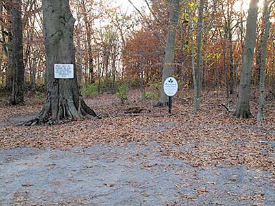
Driving Landmarks: The Albro Woods parking lot is located on Mitchells Lane approximately 0.2 miles from East Main Road. There are Albro Woods and Aquidneck Land Trust Signs at the entrance. Follow the Albro Woods trail closest to the parking area for approximately 0.1 miles. Turn right and follow the Albro Woods Trail approximately 0.1 miles to the Sakonnet Greenway Trail Kiosk.
Parking: Yes: Parking lot, 8 spaces, no overnight parking
ADA Accessible Parking Spaces? No
Coordinates: 41° 32.177' N 71° 15.814' W See this location in: Google Maps Acme Maps
Newport Vineyards Trailhead
Driving Landmarks: Park in large parking Area at the Newport Vineyards Complex, 909 East Main Road. Follow the trail south along the vineyard farm road or east toward the pond.
Parking: Yes: Parking lot, 100 spaces, no overnight parking
ADA Accessible Parking Spaces? No
Coordinates: 41° 31.733' N 71° 16.298' W See this location in: Google Maps Acme Maps
Mitchells Lane Trailhead - North
Driving Landmarks: Located just south of Newport National Golf Club (324 Mitchells Lane). Park along the east side of Mitchells Lane. Enter the trail at the kiosk.
Parking: Yes: On street, 6 spaces, no overnight parking
ADA Accessible Parking Spaces? No
Coordinates: 41° 31.769' N 71° 15.532' W See this location in: Google Maps Acme Maps
Mitchells Lane Trailhead - South
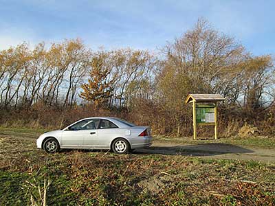
Driving Landmarks: This trailhead is about 0.1 miles south of the Mitchells Lane Trailhead - North. Park along side of field near kiosk (do not block farm road) and enter trail.
Parking: Yes: Parking lot, 6 spaces, no overnight parking
ADA Accessible Parking Spaces? No
Coordinates: 41° 31.699' N 71° 15.535' W See this location in: Google Maps Acme Maps
Wyatt Road Soccer Complex Trailhead
Driving Landmarks: Enter the Wyatt Road Soccer Complex at upper driveway, approximately 0.1 miles from the intersection of Mitchells Lane and Wyatt Road. Drive down through the complex and park near the kiosk. Enter the trail northeast along the perimeter of the soccer field or west along the woodchip path.
Parking: Yes: Parking lot, 20 spaces, no overnight parking
ADA Accessible Parking Spaces? No
Coordinates: 41° 31.316' N 71° 16.008' W See this location in: Google Maps Acme Maps
The 60 bus stops at various points along East Main Road, within walking distance of a number of the trailheads. See the trail map for information on how to get from East Main Road to the trailheads.
Do you have comments, corrections or additions to the information about this site?
Help us work together to make this website better by sharing your knowledge!


Private feedback goes to the Blueways Alliance/RI Land Trust Council. We'll use your information to make this website better or pass it along to the people who can deal with physical issues at this site. Public comments are posted here (once they've been reviewed and approved) for all to see.
The data on this website come from many sources, including volunteers and organizations across the state of Rhode Island and nearby parts of Massachusetts. We have done our best to make sure the data are accurate and up to date, but any information critical to the success of your trip should be confirmed before you start. The maps and information on this website should not be substituted for topographic maps or other more detailed maps and guides. We welcome corrections and additions. To send a correction or provide other feedback, please use our feedback form (see link above).
This site report was last updated on October 2, 2019



Comments:
Bicycles?!
Submitted by: Larry; June 20, 2022; 3:31 pm
I am not sure why you would want to limit/forbid bicycles from the land trust seeing that almost no one is using these trails. Open it up to everyone.