 Weetamoo Woods
Tiverton, Town of Tiverton
![]() 7.0 miles of trail
7.0 miles of trail
Moderate
Hunting is not allowed here but it is permitted on nearby land. Wear blaze orange during hunting season. More information
Click on the "Trail Map (PDF)" button to download a PDF of the trail map that you can print and take with you on the trail.
Avenza maps are special, free maps that you can use in the Avenza app on your smart phone. These maps let you see your location on the map as you walk. Download the Avenza App for free in the Apple App Store or on Google Play
Click on the Avenza Trail Map button to "purchase" the free map for this trail from the Avenza map store. If this is your first time, Avenza will ask you to set up an account to check out. However, all Avenza trail maps listed on ExploreRI are free.
In Rhode Island the primary hunting seasons typically run from the second Saturday in September to the last day of February and from the third Saturday in April to the last day in May, however this can vary from year to year and depends on what game is being hunted. During hunting season you should wear at least 200 square inches (a hat OR a vest) of blaze orange. During shotgun deer season, which is typically in December, you should wear at least 500 square inches of blaze orange (a hat AND a vest). For more information see the RI DEM website.
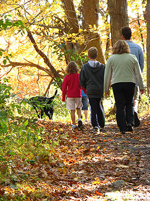
There are 7 miles of trails within Weetamoo Woods and another 2 miles in the adjacent Pardon Gray Preserve (Tiverton Land Trust). The trails have gentle slopes, rocky/rooted pathways and wet areas in spring. The trails are well-marked and maps are available the East Road trailhead. Loops are designed for easy to moderate walks.
The dominant forest of Weetamoo Woods is coastal oak-holly, a natural community of oaks and American holly trees found in coastal areas of southern New England. A large forested wetland with a stand of Atlantic white cedar is north of the sawmill with more along Borden Brook below the milldam.
The 650 acres of Weetamoo Woods are "middle-aged" forest, with some trees that survived the 1938 Hurricane now 100 - 125 years old. A mature, unfragmented forest of this size is excellent habitat for canopy nesting birds that require deep woods, such as the veery, worm-eating warbler, wood thrush and Baltimore oriole. Raptors frequenting Weetamoo include barred and horned owls, and red-tailed hawks.
Weetamoo Woods also contains 12 acres of grassland on former plowland that abuts Eight Rod Way to the east. This creates favorable conditions for ground nesting birds such as bobolinks, eastern meadowlarks and savannah sparrows.
Cultural History
Prior to European settlement, the Pocasset people fished and farmed the eastern shore of the Sakonnet Passage. Weetamoo was an honored sachem and died in the King Philip's War. After the War, in 1679, Plymouth Colony sold the "Pocasset Purchase" to colonists and Weetamoo Woods is at the south end of the original plat. Eight Rod Way, a common colonial name for road width (132 feet, a rod = 16.5 ft.) dates from that time.
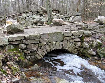
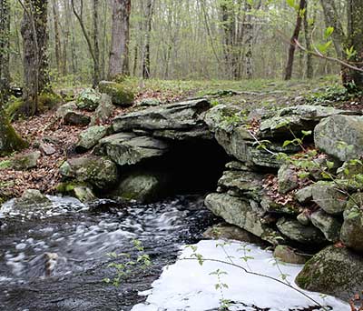
The southern part of Eight Rod Way, near the East Road entrance, retains the character of a colonial cart path with cobble paving and a slab bridge across Borden Brook. Cellar holes, farm sites, and dug wells have been found along its original path. This section was probably improved in conjunction with the sawmill (found on the Red trail) that operated in the mid 1800's.
Dogs: Dogs must be under positive control. Positive control means the dog is either on a physical leash, or under voice command and within sight. If not leashed, a leash must be carried by the person controlling the dog to be used when encountering other hikers with dogs. Owner must pick up and remove dog waste.
Horses: Horses are permitted. Parking lots do not have the capacity to handle trailers. "Walk-ins" welcome. Horses may follow edge of meadow trail but are not allowed in the open meadow.
Bicycles: Mountain bikes are permitted. No motorized vehicles.
Other Amenities: No amenities. Carry in/carry out policy. Picnicking and camping are not allowed.
East Road Trailhead
Driving Landmarks: From Route 24 in Tiverton, take Route 77 (Main Road) south toward Little Compton. After 5.5 miles, and just beyond Lafayette Road (on the left) and Seapowet Avenue (on the right), Pardon Gray Preserve (Tiverton Land Trust property) is on the left. Continue south for 2 miles, turn left at Tiverton Four corners onto East Road (Route 179). Proceed a quarter mile and the south entrance to Weetamoo Woods is on the left.
Parking: Yes: Parking lot, 12 spaces, no overnight parking
ADA Accessible Parking Spaces? No
Coordinates: 41° 34.335' N 71° 10.637' W See this location in: Google Maps Acme Maps
Lake Road Trailhead
Driving Landmarks: From Route 24 in Tiverton, take Route 81 (Stafford Road) south toward Little Compton (Continue straight at the traffic light, where Route 81 changes to Crandall Road). After 4.5 miles on 81, turn right onto to King Road. Follow King Road for 1.2 miles and take the sharp left hand curve onto Lake Road. Proceed 3/4 mile and the parking lot and trailhead are on the right.
Parking: Yes: Parking lot, 6 spaces, no overnight parking
ADA Accessible Parking Spaces? No
Coordinates: 41° 35.236' N 71° 9.767' W See this location in: Google Maps Acme Maps
Lafayette Road Trailhead
Driving Landmarks: From Route 24 in Tiverton, take Route 77 (Main Road) south toward Little Compton. After 5.5 miles turn left onto Lafayette Road (Seapowet Avenue on the right). Proceed 0.2 miles up Lafayette Road to where it ends at a gate. The trailhead for Weetamoo Woods and Pardon Gray Preserve (Tiverton Land Trust property) is on the right.
Parking: Yes: Parking lot, 6 spaces, no overnight parking
ADA Accessible Parking Spaces? No
Coordinates: 41° 35.669' N 71° 11.465' W See this location in: Google Maps Acme Maps
Do you have comments, corrections or additions to the information about this site?
Help us work together to make this website better by sharing your knowledge!


Private feedback goes to the Blueways Alliance/RI Land Trust Council. We'll use your information to make this website better or pass it along to the people who can deal with physical issues at this site. Public comments are posted here (once they've been reviewed and approved) for all to see.
The data on this website come from many sources, including volunteers and organizations across the state of Rhode Island and nearby parts of Massachusetts. We have done our best to make sure the data are accurate and up to date, but any information critical to the success of your trip should be confirmed before you start. The maps and information on this website should not be substituted for topographic maps or other more detailed maps and guides. We welcome corrections and additions. To send a correction or provide other feedback, please use our feedback form (see link above).
This site report was last updated on September 27, 2020


Comments:
Pardon Grey Cemetery
Submitted by: Clay; January 27, 2022; 7:56 am
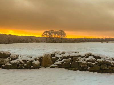
Morning view that was worth turning the car around and going back to take. Taken Jan 2020
Photographs:
Photo Credit: Clay
Day after snowstorm
Submitted by: Stephen Rebello; December 30, 2020; 10:41 am
Enjoy your hiking trails, a escape to be in the outdoors during COVID and winter days.
Rating:
Photographs:
Photo Credit: Stephen Rebello
Photo Credit: Stephen Rebello
Trail Markers
Submitted by: Anonymous; November 1, 2020; 12:25 pm
There should be more trail markers, second time there, got turned around. The fellow hiker I asked for assistance advised he had the same experience and ended up walking the road back. As I was leaving, folks I had seen earlier were walking down the street unable to navigate their way back on the trail.
Rating:
Why so little mention of Weetamoo in Cultural History?
Submitted by: Bill Conley; April 23, 2020; 8:20 pm
How about acknowledging the thousands of years that the Wampanoag/pocasset people lived and cared for this place before the Plymouth Colony stoke the land from them, killed its inhabitants in the war and sold off the survivors to slavery. If it is named after Weetamoo, give the native people more space and credit in you cultural history section.
Beautiful hike
Submitted by: Anonymous; December 28, 2019; 3:50 pm
Really pretty. Had some trouble connecting from blue trail back to yellow to do a loop so I wound up doing an out and back, but enjoyed it very much.
Rating:
Photographs: