

 George Washington Wildlife Management Area
Glocester, RI Department of Environmental Management


![]() 10.0 miles of trail
10.0 miles of trail
Moderate
Hunting is permitted here in season. Wear blaze orange during hunting season. More information
Click on the "Trail Map (PDF)" button to download a PDF of the trail map that you can print and take with you on the trail.
Avenza maps are special, free maps that you can use in the Avenza app on your smart phone. These maps let you see your location on the map as you walk. Download the Avenza App for free in the Apple App Store or on Google Play
Click on the Avenza Trail Map button to "purchase" the free map for this trail from the Avenza map store. If this is your first time, Avenza will ask you to set up an account to check out. However, all Avenza trail maps listed on ExploreRI are free.
In Rhode Island the primary hunting seasons typically run from the second Saturday in September to the last day of February and from the third Saturday in April to the last day in May, however this can vary from year to year and depends on what game is being hunted. During hunting season you should wear at least 200 square inches (a hat OR a vest) of blaze orange. During shotgun deer season, which is typically in December, you should wear at least 500 square inches of blaze orange (a hat AND a vest). For more information see the RI DEM website.


With over 4,000 acres of land, George Washington Wildlife Management Area is Rhode Island's second largest state property. There are no paved roads on the property, all are gravel and the ones closest to the campground are fairly well maintained. However these roads, called 'Trails', further from the campground area can be quite rocky and impassible for most passenger cars. In winter these gravel roads are used by snowmobiles.
The property closest to Route 44 is a state campground with tent and trailer camping. A boat launch and beach for swimming is part of the campground.
The land was acquired during the 1930's by the US Government and developed by the Civilian Conservation Corps. During WWII the land was turned over to the State of RI. The white blazed Angell Loop trail follows the shore of Bowdish Reservoir then passes by a section of the property used for tent camping. In the late 1960's Australian Navy sailors on temporary duty in Newport created what is known as the "Walkabout Trail", a series of three connected walking trails blazed blue, red, and orange. This walking trail can be rocky in spots, and passes through wetlands via 'corduroy' log bridges, a white cedar swamp, dry upland forests, and a hemlock grove. A stretch of the orange blazed trail near the Pulaski Wildlife Marsh is used for an annual bird survey.
Some of the Walkabout Trail is also the route of Rhode Island's North-South Trail, which starts near the ocean and ends at the Massachusetts state line. North-South Trail markers can be seen on those stretches of trail.
The painted trail blazes are maintained by seasonal state employees, and the Walkabout Trail is largely maintained by volunteers from the Narragansett Chapter of the Appalachian Mountain Club.
Note that the trail map published by the state is not up to date. The map below is more up to date.
State website with information on all RI State Parks, including the campgrounds.
Dogs: Yes. Must be leashed from April to October.
Horses: Yes, but only on the gravel roads, not on the walking/foot trails. Horse trailers are not allowed in the state campground area, but may park on the gravel roads beyond.
Bicycles: Bicycles are not permitted on the walking trails but are permitted on the gravel roads such as "Center Trail," "Ross Trail," etc. (see map)
Other Amenities: Restrooms, picnic tables, fishing, swimming, camping

George Washington Campground Beach Trailhead
Driving Landmarks: The address is 2185 Putnam Pike (Route 44), West Glocester, RI. It's 4.5 miles west of Chepachet village. Watch for a large "George Washington State Campground" sign. This is the entrance road to the area and the trailhead parking area is 1/4 mile down the good gravel road, near the beach.
Because of the network of gravel roads there are numerous other possible "trailheads," depending on weather, road conditions and the type of vehicle you are driving (the gravel roads may be too rough for regular passenger cars in places).
Parking: Yes: Parking lot, 30 spaces, no overnight parking
ADA Accessible Parking Spaces? Yes
Coordinates: 41° 55.383' N 71° 45.383' W See this location in: Google Maps Acme Maps
KEY:
Trailhead
Only trailheads related to this trail system are shown on this map. To see all trailheads go to the main map.
Do you have comments, corrections or additions to the information about this site?
Help us work together to make this website better by sharing your knowledge!


Private feedback goes to the Blueways Alliance/RI Land Trust Council. We'll use your information to make this website better or pass it along to the people who can deal with physical issues at this site. Public comments are posted here (once they've been reviewed and approved) for all to see.
The data on this website come from many sources, including volunteers and organizations across the state of Rhode Island and nearby parts of Massachusetts. We have done our best to make sure the data are accurate and up to date, but any information critical to the success of your trip should be confirmed before you start. The maps and information on this website should not be substituted for topographic maps or other more detailed maps and guides. We welcome corrections and additions. To send a correction or provide other feedback, please use our feedback form (see link above).
This site report was last updated on June 18, 2020
Comments:
Kayak
Submitted by: Rain; April 19, 2025; 1:35 am
It's so beautiful and peaceful, love the trails and little, Clean Beach!
Rating:
Photographs:
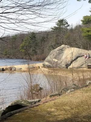
Photo Credit: Rain
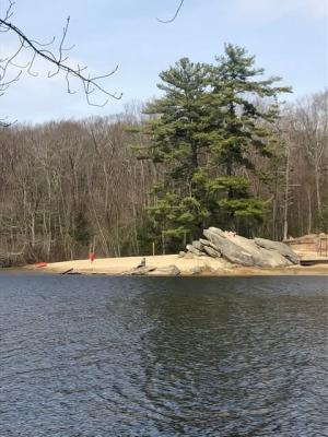
Photo Credit: Rain
Angell Loop Trail
Submitted by: Anonymous; September 20, 2021; 10:10 pm
Can you give me the background on naming the Angell Loop Trail? Curious as my Great Grandmother was from RI. She was an Angell.
[Moderator's comment: I don't know and I'm not sure who we'd ask as it's a state property. Maybe someone else will know. There are certainly lots of things in RI that seem to draw on the Angell family name.]
Throughout the trail
Submitted by: Tom Grady; September 21, 2020; 8:31 pm
Is there camping along the trail?