

 Rocky Hill Road Conservation Area
North Smithfield, North Smithfield Land Trust


![]() 0.7 miles of trail
0.7 miles of trail
Easy
Hunting is not allowed here but it is permitted on nearby land. Wear blaze orange during hunting season. More information
Click on the "Trail Map (PDF)" button to download a PDF of the trail map that you can print and take with you on the trail.
Avenza maps are special, free maps that you can use in the Avenza app on your smart phone. These maps let you see your location on the map as you walk. Download the Avenza App for free in the Apple App Store or on Google Play
Click on the Avenza Trail Map button to "purchase" the free map for this trail from the Avenza map store. If this is your first time, Avenza will ask you to set up an account to check out. However, all Avenza trail maps listed on ExploreRI are free.
In Rhode Island the primary hunting seasons typically run from the second Saturday in September to the last day of February and from the third Saturday in April to the last day in May, however this can vary from year to year and depends on what game is being hunted. During hunting season you should wear at least 200 square inches (a hat OR a vest) of blaze orange. During shotgun deer season, which is typically in December, you should wear at least 500 square inches of blaze orange (a hat AND a vest). For more information see the RI DEM website.

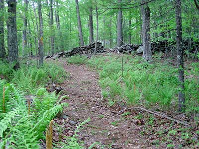
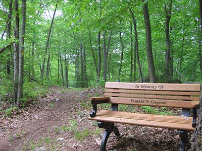
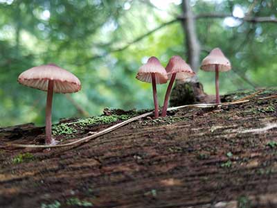

Those in search of a short walk in the woods will enjoy the trail at the North Smithfield Land Trust's Rocky Hill Conservation Area. There are about 0.7 miles of trails here. Enter the trail at the North Smithfield Land Trust sign across from 382 Rocky Hill Road. Follow the yellow blazes down the trail over bridges and past old stone walls. Just past the second bridge the trail splits. Follow it in either direction to loop around and return to the split. Observe birds, small mammals, plenty of ferns, and a vibrant fungus community after rain. In keeping with the name, the trail can be rocky in places. Walk carefully after leaf fall and when there is snow on the ground.
Dogs: Yes, Please keep dogs leashed and pick up waste.
This is a Creature Challenge site. The creature is on the Yellow Trail.
Learn more about the Creature Challenge.

Rocky Hill Road Trailhead
Driving Landmarks: This trailhead is on Rocky Hill Road, 0.7 miles from the T-junction at Grange Road. The trailhead is across the street from 382 Rocky Hill Road, North Smithfield.
Parking: Yes: On street, 2 spaces, no overnight parking
ADA Accessible Parking Spaces? No
Coordinates: 41° 56.857' N 71° 31.69' W See this location in: Google Maps Acme Maps
KEY:
Trailhead
Only trailheads related to this trail system are shown on this map. To see all trailheads go to the main map.
Do you have comments, corrections or additions to the information about this site?
Help us work together to make this website better by sharing your knowledge!

Private feedback goes to the Blueways Alliance/RI Land Trust Council. We'll use your information to make this website better or pass it along to the people who can deal with physical issues at this site. Public comments are posted here (once they've been reviewed and approved) for all to see.
The data on this website come from many sources, including volunteers and organizations across the state of Rhode Island and nearby parts of Massachusetts. We have done our best to make sure the data are accurate and up to date, but any information critical to the success of your trip should be confirmed before you start. The maps and information on this website should not be substituted for topographic maps or other more detailed maps and guides. We welcome corrections and additions. To send a correction or provide other feedback, please use our feedback form (see link above).
This site report was last updated on September 21, 2023
Comments:
Swimming in gorton pond Warwick
Submitted by: William Moore ; January 22, 2023; 2:27 am
Born in 1938 and throughout world war II it was possible to swim in Gorton pond although the APPAnog company polluted it with its discharge. Has it been cleaned up now so it is swimmable?
[Moderator's Comment: Gorton Pond has a public beach on it so while I do not have specific information on the cleanliness of the water I presume the City of Warwick is monitoring the water quality and has deemed it safe for swimming.]