

 Haile Farm Preserve
Warren, Warren Land Conservation Trust

![]() 1.5 miles of trail
1.5 miles of trail
Easy
Click on the "Trail Map (PDF)" button to download a PDF of the trail map that you can print and take with you on the trail.
Avenza maps are special, free maps that you can use in the Avenza app on your smart phone. These maps let you see your location on the map as you walk. Download the Avenza App for free in the Apple App Store or on Google Play
Click on the Avenza Trail Map button to "purchase" the free map for this trail from the Avenza map store. If this is your first time, Avenza will ask you to set up an account to check out. However, all Avenza trail maps listed on ExploreRI are free.
In Rhode Island the primary hunting seasons typically run from the second Saturday in September to the last day of February and from the third Saturday in April to the last day in May, however this can vary from year to year and depends on what game is being hunted. During hunting season you should wear at least 200 square inches (a hat OR a vest) of blaze orange. During shotgun deer season, which is typically in December, you should wear at least 500 square inches of blaze orange (a hat AND a vest). For more information see the RI DEM website.
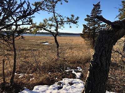
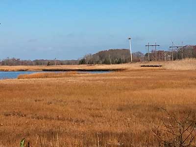
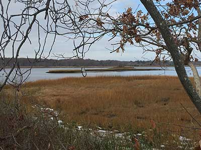
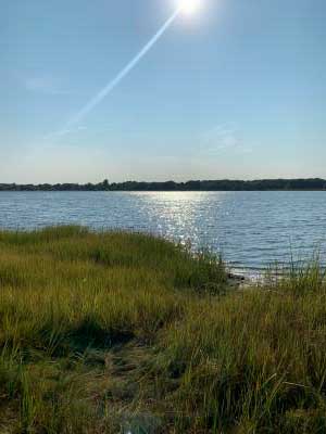
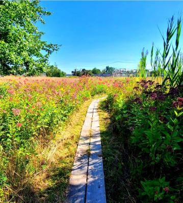
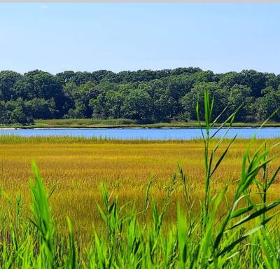


Red maple woodlands give way to coastal scrublands and salt marshes along the Palmer River on the new Haile Farm Preserve. The trails loop through the woods, with spurs out onto the salt marsh, providing beautiful views of the marsh and the river. Bald eagle, osprey and deer, as well as a wide variety of insects, plants, mosses and fungi all live here.
Unusually high tides inundate the salt marsh so during and after such tides the marsh trails will be wet, and after heavy rains the all trails will be moist.
Warren Land Conservation Trust Properties We Protect page
Dogs: Dogs must be leashed and picked up after at ALL times.
This is a Creature Challenge site. The creature is on the Dick Hallberg Trail (Green Trail).
Learn more about the Creature Challenge.

New Industrial Road Trailhead
Driving Landmarks: The trailhead is on a side street called "New Industrial Way," which takes off from Old Market Street. From the center of Warren head north on Route 136 (Market Street) and turn left onto Old Market Street. Go 0.6 miles on Old Market Street and then turn left onto New Industrial Way. The trailhead is 0.1 miles down New Industrial Way, on the left, at the turn-around. There is a small parking pull-out with space for three cars. If those spaces are full you can also park on the street.
Parking: Yes: Parking lot, 3 spaces, no overnight parking
ADA Accessible Parking Spaces? No
Coordinates: 41° 45.051' N 71° 16.475' W See this location in: Google Maps Acme Maps
KEY:
Trailhead
Only trailheads related to this trail system are shown on this map. To see all trailheads go to the main map.
Do you have comments, corrections or additions to the information about this site?
Help us work together to make this website better by sharing your knowledge!


Private feedback goes to the Blueways Alliance/RI Land Trust Council. We'll use your information to make this website better or pass it along to the people who can deal with physical issues at this site. Public comments are posted here (once they've been reviewed and approved) for all to see.
The data on this website come from many sources, including volunteers and organizations across the state of Rhode Island and nearby parts of Massachusetts. We have done our best to make sure the data are accurate and up to date, but any information critical to the success of your trip should be confirmed before you start. The maps and information on this website should not be substituted for topographic maps or other more detailed maps and guides. We welcome corrections and additions. To send a correction or provide other feedback, please use our feedback form (see link above).
This site report was last updated on September 21, 2023
Comments:
Another magical trail
Submitted by: Mary ST. ; September 17, 2024; 10:31 am
You walk in surrounded by flowers and leave the same way. Easy walk, beautiful place.
Rating:
Photographs:
Photo Credit: Mary ST.
Photo Credit: Mary ST.
Photo Credit: Mary ST.
Excellent trail with awesome views.
Submitted by: Robb S; September 16, 2024; 9:46 pm
One of the best trails yet. Excellent trails with Awesome view. Very well-maintained trails. We will return to do it again.
Rating:
Photographs:
Photo Credit: Robb S
Photo Credit: Robb S