

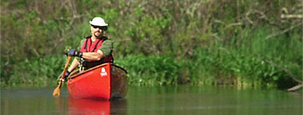
Paddle Across Rhode Island 2014 a Success!
UPDATE: The paddlers reached Westerly and completed the paddle on Sunday, July 13!
The story of the journey from start to finish, on EcoRI News.
For more news from the paddlers visit the Facebook page for the trip.
More news coverage:
- Providence Journal story
- Rhode Island Public Radio story
- Woonsocket Call - June 30
- Woonsocket Call - July 6
- NBC 10
- ABC 6
- EcoRI News and EcoRI News
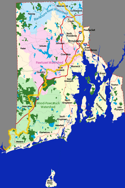
This July, four experienced canoeists will attempt become the first to canoe across the State of Rhode Island, north to south, using a primarily inland route. Their adventure will start in the Town of North Smithfield, and they will paddle and portage their way on a meandering route that will take them through seventeen of the state’s thirty-nine cities and towns, eventually ending in Westerly. Their chosen route will take them along eight different rivers, as well as a portion of upper Narragansett Bay. An attempt to do the same trip was thwarted last year by floods associated with the untimely arrival of Tropical Storm Andrea last June.
The idea for the trip was hatched three years ago by Chuck Horbert, 46, of North Scituate, RI. Says Horbert, “While paddling down the Blackstone River, I jokingly asked a bystander how far I had to go to reach Westerly. It was a crazy question intended only to get a laugh, but I then thought to myself: Was it possible?” So he pulled out maps, and consulted Google Earth photos, and found that it was. Since then, he has been researching the details, such as identifying portage routes around obstacles such as dams, and scouting out potential campsites.
Early on in the planning, he started pitching the trip to other friends, hoping to find at least one or two other canoeists skilled and crazy enough to accompany him on this historic expedition. This year, he managed to entice Jim Cole, 67, of Charlestown, RI (who was also part of the team last year), Bill Luther, 62 of Seekonk, MA, and Dave Smith, 57, of Westerly to sign on for the duration. Cole is an American Canoe Association certified canoe instructor, and author of “Paddling Connecticut and Rhode Island”, a paddling guidebook published in 2009. Luther has over 30 years of canoeing experience, visiting rivers and lakes all over the country. Chuck, Bill and Jim are members and former Presidents of the RI Canoe & Kayak Association. Over the last six years they, with other canoeists, have been paddling sections of the Northern Forest Canoe Trail, a 740-mile long water trail stretching from Old Forge, NY to Fort Kent, ME. “It was this experience that gave me the confidence to make this attempt to paddle across Rhode Island”, said Horbert.
Having realized the potential to use the trip to advocate for improved river access, he brought a proposal before his fellow board members at the Rhode Island Blueways Alliance to develop and coordinate a number of events along the route to highlight the many new paddler access projects that various municipalities and watershed groups had accomplished. The original short list of events has since morphed into multiple programs ranging from simple educational presentations with youth groups to a major event intended to highlight the potential designation of a National Park along the Blackstone River.
Keith Gonsalves, President of the Rhode Island Blueways Alliance, said that “this canoe trip, and the planned interaction with so many cities, towns and watershed groups, seemed a perfect way to promote our goals to develop water trails throughout the state and to promote recreation and economic development by reconnecting communities with the rivers that flow through them.”
The four, with one or two other canoeists who will accompany them for a short segment of the trip, will meet in North Smithfield at the state border, and head down the Blackstone River. They hope to reach Cumberland that day. They will camp each night of the trip at pre-selected campsites for which they have obtained landowner permission to use. They will practice leave-no-trace camping principles, leaving all campsites in as good or better condition than when they arrived. All but one planned campsites are on publicly owned land.
Likely the toughest segment of the trip will be an upstream paddle up the Pawtuxet River watershed over two days from Pawtuxet Cove to the Big River Management Area. Says Cole, who grew up along the Pawtuxet River, “this will present a significant challenge, especially if the water levels are high, but I think we’re up to it.” One segment of the South Branch of the Pawtuxet River, which contains 7 different dams in a short stretch of river, will be bypassed by walking along the Washington Secondary Bike Path.
The longest portage, 9.5 miles, will bring the canoeists out of the Pawtuxet River Watershed into the Wood-Pawcatuck River Watershed, mostly via state highway. Folding canoe carts will be used to assist in this and other portages.
And on Sunday, July 13th, if all goes well, a happy and tired group of canoeists will be pulling onto a public boat ramp on Little Narragansett Bay, having reached Westerly.
Updates on the planning for the trip, and during the trip itself, can be viewed by going to and liking a Facebook page for the trip.