

 Charlestown Breachway
41° 21.532' N 71° 38.296' W See this location in: Google Maps Map Server Acme Maps
This is a site for launching boats from trailers. Boat ramps can normally be used to launch canoes and kayaks but please do your best to keep the boat ramp clear for boat trailers.
Description & Overview:

There is an entrance fee to use this area during the summer season. Launching at this site provides access to both Ninegret Pond and Block Island Sound. Great caution must be used at this site! The tide runs hard through the Breachway and if drawn into the Breachway on a ebb tide you are likely to end up in heavy and dangerous seas at the mouth of the Breachway.
The put-in at Charlestown Town Beach is a better place to launch kayaks and other non-motorized small boats.
Ninigret Pond is Rhode Island's largest coastal salt pond and offers excellent wildlife viewing possibilities, but the wind, tides and motor boat traffic mean it is not a place for inexperienced paddlers. On most days the southwest wind fills in across this area in the morning and blows throughout the afternoon, so be prepared for this when planning your trip.
This site provides access to the following water bodies: Ninigret Pond, Block Island Sound.
Location:
Town: Charlestown
Nearest Town Center: Charlestown Beach
Driving Landmarks: On Route 1 north (if you are on Route 1 south go past the exit and reverse direction), at 0.9 miles after the General Stanton Inn, take the Charlestown Breachway/Beach Exit onto Narrow Lane. Continue 0.9 miles and take a left at the second stop sign onto Matunuck School House Road. 0.2 miles later take a right onto Charlestown Beach Road. Follow this winding road for 1.4 miles. After you cross the bridge stay left at the first fork and then bear right shortly thereafter onto Breachway Road. The RI DEM park entrance is a mile ahead at the end of this road. The boat ramps are at the north end of the parking lot. Directions adapted from "Kayaking Narragansett Bay" by Ed Mullen.
Access & Waters:
Water 'Features' At Site: estuary, ocean/bay
Note: Because one boat launch can access, say, both a lake and a river or both the upstream and downstream portions of a river, not all paddling trips at a given site will necessarily encounter all of the features listed.
Type of Access: Boat ramp
ADA Accessible Boat Launch? no
Shoreline: Twin concrete plank boat ramp with sand and gravel shoreline adjacent to the ramps.
Float/Dock: no
Hours of Operation: Open 8am to 5pm during beach season. Open 24/7 in off season.
Fees: Yes, during beach season.
Parking:
Parking: yes: 350 spaces
ADA Accessible Parking Spaces? no
Nearby Amenities:
Public Restrooms: Portable toilets are usually available here during the beach season.
Sources for More Information:
AMC Quiet Water Canoe Guide: 2nd Edition, page 208
Other Guidebooks: Site 38 in Ed Mullen's book "Kayaking Narragansett Bay", also Salt Ponds Coalition Kayaker’s Guide
Website: Information about this access site on the Sea Kayak Access Sites for Coastal Rhode Island website
Website: Salt Ponds Coalition Kayaker’s Guide to the Coastal Salt Ponds of South County, RI
Photographs:
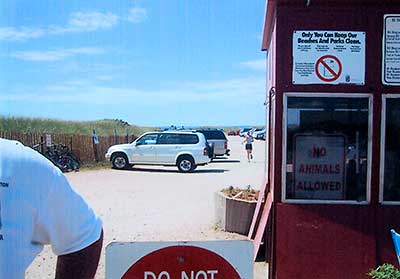
Entrance to Charlestown Beach
Photography by: Art Ganz and Bambi Poppick
Date of Photograph: August 17, 2006
Do you have comments, corrections or additions to the information about this site?
Help us work together to make this website better by sharing your knowledge!

Private feedback goes to the Blueways Alliance/RI Land Trust Council. We'll use your information to make this website better or pass it along to the people who can deal with physical issues at this site. Public comments are posted here (once they've been reviewed and approved) for all to see.
The data on this website come from many sources, including volunteers and organizations across the state of Rhode Island and nearby parts of Massachusetts. We have done our best to make sure the data are accurate and up to date, but any information critical to the success of your trip should be confirmed before you start. The maps and information on this website should not be substituted for nautical charts, topographic maps, or other more detailed maps and guides. We welcome corrections and additions. To send a correction or provide other feedback, please use our feedback form (see link above).
This site report was last updated on June 5, 2011