

 South Water Street Landing
41° 49.34' N 71° 24.358' W See this location in: Google Maps Map Server Acme Maps
This is a site for launching hand-carried boats such as canoes or kayaks.
Description & Overview:

This boat launch is at the southern end of the "canal" that carries the Providence River through Providence. So, it is a good place at which to launch or take out for trips on the Providence, Woonasquatucket and Moshassuck Rivers. It is also a suitable launch for trips down the Bay. Great caution should be exercised if you go beyond the hurricane barrier because of the heavy commercial traffic in this area. When Waterfire is taking place the river is closed to traffic just up river from this site.
This put-in is on the new Roger Williams Trail that traces the route Roger Williams and his followers took in 1636 when they paddled by canoe from what is now East Providence to Providence, to settle and found what would become the state of Rhode Island.
You can also rent kayaks and go on guided urban paddling tours from Waterplace Park with the Providence Kayak Co.
This site provides access to the following water bodies: Providence River, Woonasquatucket River.
Location:
Alternate Site Name: Harbor View Park
Town: Providence
Nearest Town Center: Providence
Driving Landmarks: From I-95 North or South take at Exit 22A in downtown Providence. At the first light, go straight onto Memorial Boulevard. At the sixth light, turn left onto Crawford Street, which will put you on a bridge across the Providence River. This is the last bridge across the river before the I-195 bridge. After you cross the river the road makes a sharp right turn. You are now on South Water Street. The landing is about 2/10 mile ahead on your right, near the round gazebo and the circular silver sculpture. There is on-street parking on both sides of the street near the landing.
Access & Waters:
Water 'Features' At Site: estuary, ocean/bay
Note: Because one boat launch can access, say, both a lake and a river or both the upstream and downstream portions of a river, not all paddling trips at a given site will necessarily encounter all of the features listed.
Type of Access: Boat launch for hand carried boats
ADA Accessible Boat Launch? no
Shoreline: There is a hard surface ramp (not usable by trailers) leading down into the water as well as broad concrete steps next to the ramp. The adjacent shoreline is stabilized.
Float/Dock: no
Approximate Length of Carry between Car Access and Water: 50 feet
Hours of Operation: 24/7, year-round
Parking:
Parking: on street, no overnight parking
ADA Accessible Parking Spaces? no
Nearby Amenities:
Public Restrooms: There are numerous restaurants and other businesses nearby so a restroom should not be hard too find.
Sources for More Information:
AMC River Guide: Fourth Edition, page 145
Website: Roger Williams Trail Map (PDF)
Photographs:
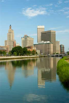
View up the Providence River from near the boat launch
Photography by: Kenneth C. Zirkel
Do you have comments, corrections or additions to the information about this site?
Help us work together to make this website better by sharing your knowledge!

Private feedback goes to the Blueways Alliance/RI Land Trust Council. We'll use your information to make this website better or pass it along to the people who can deal with physical issues at this site. Public comments are posted here (once they've been reviewed and approved) for all to see.
The data on this website come from many sources, including volunteers and organizations across the state of Rhode Island and nearby parts of Massachusetts. We have done our best to make sure the data are accurate and up to date, but any information critical to the success of your trip should be confirmed before you start. The maps and information on this website should not be substituted for nautical charts, topographic maps, or other more detailed maps and guides. We welcome corrections and additions. To send a correction or provide other feedback, please use our feedback form (see link above).
This site report was last updated on June 21, 2019