

 Pratt's Landing
42° 0.834' N 71° 0.882' W See this location in: Google Maps Map Server Acme Maps
This is a site for launching hand-carried boats such as canoes or kayaks.
Description & Overview:

This new launch site is 1/3 mile upriver from War Memorial Park. The river in this area is generally quiet and slow so it is very possible to paddle both upstream and downstream. Lake Nippenicket is a little over 3 miles upstream from here. The last section of river before you get to the lake, upstream of the Route 24 bridge, is VERY narrow, winding and brushy. While water depth is not likely to be an issue, this part of the Town River is best paddled in the spring when the brush may be a little less thick. Even so, longer canoes will have a harder time than shorter boats, kayakers will find much of the channel too narrow to use their paddle normally, and sea kayaks are definitely not recommended.
This site provides access to the following water bodies in the Taunton River watershed: Town River.
Location:
Town: West Bridgewater
Driving Landmarks: Pratt's Landing is at 204 River Street, just east of the junction with Forest St.
Access & Waters:
Water 'Features' At Site: flatwater/slow moving river
Note: Because one boat launch can access, say, both a lake and a river or both the upstream and downstream portions of a river, not all paddling trips at a given site will necessarily encounter all of the features listed.
Type of Access: Boat launch for hand carried boats
Shoreline: A gently sloping but possibly muddy at times shoreline. In season there is a plastic dock to launch from.
Float/Dock: low float or dock
Approximate Length of Carry between Car Access and Water: 75 feet
Parking:
Parking: yes: 4 spaces
Photographs:
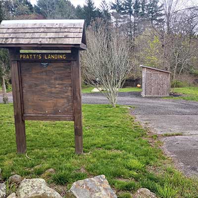
Pratt's Landing
Photography by: Craig
Date of Photograph: April 30, 2024
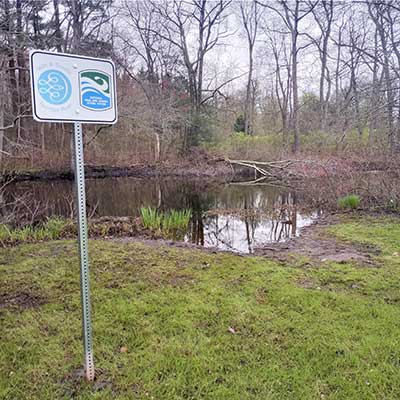
The shoreline at Pratt's Landing (without the dock)
Photography by: Craig
Date of Photograph: April 30, 2024
Do you have comments, corrections or additions to the information about this site?
Help us work together to make this website better by sharing your knowledge!

Private feedback goes to the Blueways Alliance/RI Land Trust Council. We'll use your information to make this website better or pass it along to the people who can deal with physical issues at this site. Public comments are posted here (once they've been reviewed and approved) for all to see.
The data on this website come from many sources, including volunteers and organizations across the state of Rhode Island and nearby parts of Massachusetts. We have done our best to make sure the data are accurate and up to date, but any information critical to the success of your trip should be confirmed before you start. The maps and information on this website should not be substituted for nautical charts, topographic maps, or other more detailed maps and guides. We welcome corrections and additions. To send a correction or provide other feedback, please use our feedback form (see link above).
This site report was last updated on May 14, 2024